
Kauai Presentation
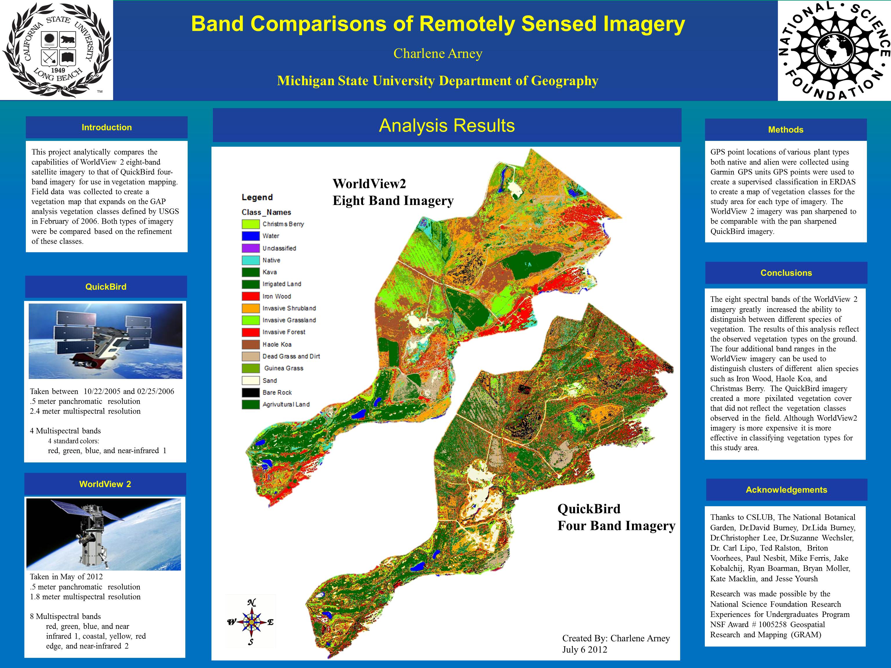
This project analytically compares the capabilities of WorldView 2 eight-band satellite imagery to that of QuickBird four-band imagery for use in vegetation mapping. Field data was collected to create a vegetation map that expands on the GAP analysis vegetation classes defined by USGS in February of 2006. Both types of imagery were be compared based on the refinement of these classes.